This chase was a classic warm front chase with a strong warm front setting up right along the KS/NE border. To the north of the front was strong easterly flow at the surface that caused a ton of low level shear for storms to work with. I left early in the afternoon and made it to Holdredge, NE by late afternoon. The area of potential storms was fairly large so I waited here for initiation. Finally storms started to form in SW Nebraska almost near the border with Colorado. I headed west towards McCook. After a while two separate storms formed with the storm furthest southwest becoming tornado warned first. The storm was in a horrible area for roads though and as I approached there was another storm northwest of McCook that looked good and became tornado warned so despite there being a tornado on the ground with the other storm, I went for the one that was closest. I eventually turned north towards the storm on the local gravel roads. Many of you know of my past experience with gravel roads so I have a real hesitation to use them, but there was no other choice. It hadn't rained here yet so the roads were fine. I made it to the storm and though it looked really impressive, I could tell it would be hard to see a tornado due to it's high precip.
I use Microsoft's Streets and trips for my mapping software and it's normally a very good software. However sometimes it shows roads that aren't there or actually section lines or some other type of very low maintenance road. At some point I had the decision of continuing to follow the first storm, or drop back southwest towards the other storm that was still supposedly producing a tornado. Well, I decided to keep on the first storm and thought I had a route picked out around this big lake and some kind of a rec area. My route around the lake though ended up being basically a wagon looking trail. So i had to bail back south as the storm overtook me. Luckily I made it out of the storm before the roads turned to soup.
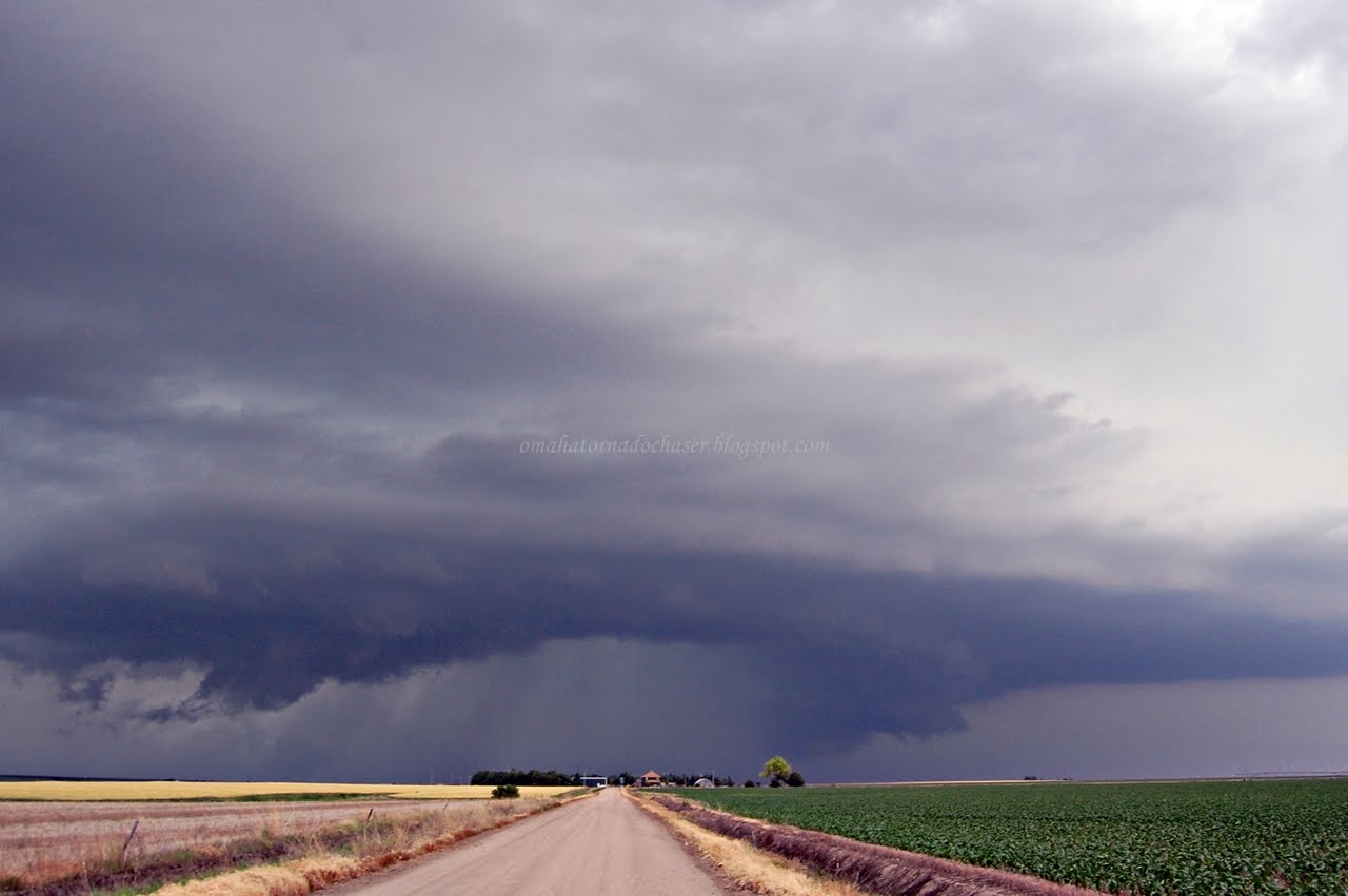
With the first storm now moving away, I waited for the next storm to come in from the west. This storm allegedly had a tornado with it on the ground about 6 miles away from me. However, from where I stopped I had a great vantage point of the storm and the wall cloud and could see no tornado. This has happened on more than one occassion this year where I was seemingly in a good spot to see a tornado where one was reported but saw nothing.
I let this storm come just to the north of me and it visually kind of looked like it was weakening. The wall cloud had disappeared anyways. The storm also had started to turn a little to the southeast in it's direction. I continued to follow it though on gravel roads. I was almost back to the area around McCook. I didn't want to go through town though because I felt like I would lose the storm then. Again, I found a route on my mapping software and headed east. The road looked a little questionable, but I continued on. I came to my turn and the road didn't exist! The road I was currently on wasn't even a gravel road, it was just basically dirt. I turned around right away but the storm had started to come over me. It started raining really hard and immediately the road started to turn to mud. It was actually scary how fast the road turned bad. I began to slightly panic as I started to slide around a little bit as I drove back to the west. Thankfully I only had about 1.5 miles to go before I got back to the main gravel road, and I made it without getting stuck.
I found another road that brought me back to the main highway just east of McCook. By now I had run into the hoards of chasers that were out on this storm. The road turned to the northeast so the storm was basically following the main highway and I was now behind the storm. I would try to get through the storm but it was too dangerous, and there were constant tornado reports coming in with a tornado on the ground. I couldn't see anything from behind the storm and was very frustrated on how the day was turning out. Eventually, I decided to head south and weaved my way through more gravel roads until I hit the next main east/west highway. By now I was almost near the Kansas border. However the main storm that I had been following had turned southeast and actually wasn't that far away from me. It was still tornado warned and even though it was dark, I thought I would still keep an eye on it and try to get different views of the storm as the roads would allow me. The lightning was pretty spectacular so it allowed me to see the base of the storm. However, I never did see any tornadoes. I stopped and took a lot of great lightning pics that I will put in a separate post. With stopping so often to get pics and the long route I took, I didn't get home til almost 4 in the morning! Tired and disappointed again, I knew I would still have another, perhaps better chance the next day...
first storm of the day, HP supercell

another shot

again


wall cloud off to the west of me with 2nd storm

wall cloud falling apart as storm approaches

storm looks weaker

south of the big tornado warned storm as I had to drive around the storm. loved the bluish look to the storm

again
some radar grabs:

800 pm- the two big tornado warned storms

806 pm- large hook on storm

811 pm- I'm the white circle just below the storm. supposedly there was a tornado on the ground right around this time, but i didn't have visual of it

855 pm- tornado heading thru Indianola. I'm the white circle just to the left of the town

radar grab of all the tornado warned storms at once. an impressive shot!
Total miles: 765
no hail or tornadoes

No comments:
Post a Comment