Wednesday, September 15, 2010

Omaha shelf cloud 9/15/10

a nice little severe storm blew threw omaha with 60 mph winds and penny to quarter sized hail. i worked til 7 and watched the storm on the radar. unfortunately, i waited too long to get out to take some pics, so i had to kindof take pics while driving. it was one of the cooler looking storms i've seen in quite a while! you could really see the rotation of the storm as it approached overhead, and on the northern edge of the storm where i was closer too at one point, there was scud rapidly rising in the updraft of the storm. sarah and i went north for a while before i could see that the storm was going to go further south so we went back south down 132nd street. we ran into very heavy rain and soon hail up to penny sized. it was coming down so hard that we had to pull over in our church parking lot until it let up! we headed home, and as we were coming down our street we first noticed one tree that had a fairly large branch broken, and then 2 houses down from us we saw an entire 15-20 feet tall tree was uprooted from the ground. i wish i would have gotten out about 1o minutes earlier to get some better pics, but it was still a nice little storm!


radar grabs of the storm as it moved through the town


Friday, August 20, 2010

Selling my photos!!

i've decided to start to try and sell some of my storm chasing pics. i found a site that allows me to post my pics for free, and when i sell a pic they keep a commission out of the sale amount. it kindof stinks to have to pay a commission, but at least this way i'm not paying a monthly fee when i'm not selling my stuff. hopefully i'll get a few orders. i'm not expecting much, but even a handful of sales is better than nothing! as a side note to my friends and family, if you see a picture that you want, let me know and i am sure we can work out a deal on the price!! tell your friends too!!

here's the web address of the photography site:

http://omahatornadochaser.blogspot.com.instaproofs.com/

Saturday, August 14, 2010

Wilkin county Minnesota EF-4 tornado

On August 7th, an EF-4 tornado touched down in western Minnesota near the border with North Dakota. I am making a post of this because it was, I believe, the 12th EF-4 rated tornado this year. This year has been pretty normal for numbers of tornadoes but for the number of violent tornadoes, it has been a very high number. 5 of those EF-4's were in Minnesota too, which has become the new tornado central for the U.S.!! There is also some amazing video of this violent tornado. this time of year, there aren't a lot of chasers out, so it's always a treat to be able to still see pics and videos of these storms. the tornado was a very narrow, "drill bit" tornado. normally people think violent tornadoes are large, very wide tornadoes, but this one was a slow moving, narrow, but very violent tornado. luckily the farms that were destroyed had no one home at the time. a pickup truck at one of the farms was thrown 1/2 a mile with the engine block from the truck thrown 2/3 of a mile. a sugarbeet field was heavily scarred with some of the beets pulled out of the ground! i've posted some links to videos and pics and storm info below:

damage survey:
http://www.crh.noaa.gov/fgf/?n=20100807_tor_wilkin

some videos:
http://www.youtube.com/watch?v=Z-4Nu1r3510&feature=player_embedded

http://www.youtube.com/watch?v=509woimlfD4

http://www.youtube.com/watch?v=cjvlsBIEss4&feature=related


pics:
http://www.mnwxchaser.com/10august07.html

http://www.chasethestorms.com/Other/Spring-2010/12006343_P5snn#962067920_WzMwo-A-LB

Tuesday, August 10, 2010

Omaha intense heat wave 8/8-8/13 and lightning pics

So, I've decided to keep posting on my blog, even though i'm not chasing anymore this year. I am going to try and post "interesting" weather events that happen, even if I don't chase them or involve severe weather and tornadoes. This past week Omaha, and most of the midwest experienced an extreme heat wave that lasted most of 6 days. Here in omaha we were under an excessive heat warning from Sunday 8/8 to Friday 8/13. This type of warning is issued when daytime heat indexes are forecast to be over 105, and nighttime heat indexes are not supposed to drop below 80 degrees. This was one of the hotter, and most humid streaks I've experienced in a while. What's interesting is that even though it was so hot, highs never went above 100 here in Omaha. This was because since it was so humid, the air couldn't warm up as much as drier air. Several evenings at 10 o'clock during the week, the air temperature was still near 90, and the heat index was between 105 and 110 degrees, still at 10 o'clock at night!! I've posted the temps and a link from this past week highlighting the heat and humidity.

http://www.crh.noaa.gov/images/oax/news/OAXHI080810.png
** note some heat index values were 119 degrees up to 122 degrees in southwest iowa. it's normally always more humid there due to the transporation of moisture from the thick corn crops!!

Sunday- Low 76 High 96, max heat index= 117
Monday-Low 73 High 95, max dewpoint= 81 max heat index= 115
Tuesday- Low 78 High 95, max dewpoint= 80 max heat index= 108
Wednesday- Low 74 High 99, max dewpoint= 75 max heat index= 107
Thursday- Low 76 High 97, max dewpoint= 79 max heat index= 113, temp at 10 pm 89 heat index 104, temp at 11 pm 87, heat index 97
Friday- High 94, low Friday morning was 81!! max dewpoint=75 max heat index= 104

on tuesday night there was a severe tstorm that developed in southeast nebraska, and moved northeast towards omaha. it ended up going south of town and through the suburb of bellevue, nebraska where it produced 74 mph winds and knocked down some trees and branches. i went out on our back deck and took some pics. i had a perfect view between the trees in our backyard of the lone thunderstorm. it was cool to see surrounded by the stars, and this huge thunderhead lit up with nearly constant lightning. i only got a couple of pics though before some low clouds from the storm blew out and eventually blocked my view of the lightning in the storm.

Sunday, August 8, 2010

8/3/10 Omaha big hail and lightning pics

omaha had a small, but very intense storm move over parts of southwest and southern areas of town this evening. the day was very warm and the atmosphere was extremely unstable. right at sunset, storms started to fire over the area. one storm formed northwest of town and became severe as it moved southeast. the first reports of large hail were in elkhorn west of town where ping pong sized hail(1.5") was reported. the storm strengthened until there were several reports of baseball and larger sized hail up to 3" in diameter. the area affected was small but there were several reports of busted out windshields, and one car dealership had severe damage. the area hit hardest was in ralston, which is a southern suburb of omaha.
i went out to take lightning pics, first north of town up I-29, then headed back towards northern Omaha. the storm that was dropping the hail stayed far enough south that i couldn't get any good pics. i headed south down I-29 and started to run into heavy rain. i had to turn on my wipers on high and not more than 10 seconds later, the wipers crossed each other causing the drivers side wiper to basically explode off the windshield, leaving me blind driving down the interstate! i was able to pull over safely to the shoulder, and had to wait til the rain let up to continue onto an exit that i could park at. i was with a friend, and we continued on to south of council bluffs where we got some decent pics of the storms.
here's some links to some pics and a news story:
http://www.wowt.com/home/headlines/99916209.html

http://ulocal.ketv.com/_Giant-Hail/p.../62922.html?b=
http://ulocal.ketv.com/_hail/photo/1.../62922.html?b=


Friday, July 30, 2010

U.S. record sized hail and fatal Montana tornado

There were two extreme weather events within a couple of days of each other this last week of July. First off, a huge supercell thunderstorm formed in central south dakota on the afternoon of july 23, 2010. This storm moved into the town of vivian, south dakota where it dropped the record hailstone. vivian is 30 miles south of pierre on I-90 and i've driven by vivian numerous times in my years of living in south dakota. the record stone ended up being 8" in diameter, and 18.625" in circumference! it also weighed almost 2 pounds. as a comparison, a volleyball is only about a 1/2" bigger in diameter, but is much bigger in circumference due to it being perfectly spherical. The previous record was for a 7" diameter stone that fell several years ago in Aurora, Nebraska, and that stone still has the record for circumference at 18.75"!! one home had 18 holes punched through it's roof, with a few of the holes coming through the ceiling, so the stones were laying on the floor inside the house! the record setting stone was actually larger, but it wasn't found until an hour and a half after the storm ended. also the person that found the stone, lost power during the storm so his freezer wasn't working for several more hours!! it is believed that it was possible for some of the stones to be as large as 10 or 11 inches!! many 6" or larger stones were also found. for those who don't know how hail forms, intense updrafts in a thunderstorm are needed to push the hail higher and higher so it can continue to freeze and add more ice. meteorologists estimate that the updrafts in this storm had to be 160-180 mph in order to hold hailstones this size!!!

here's some links and pics from this storm:

http://www.crh.noaa.gov/abr/?n=stormdamagetemplate

http://www.mitchellrepublic.com/event/article/id/45038/


divot left in ground from stone


Then on july 26th, an EF-3 tornado touched down in northeast montana, killing 2 people and injuring 1 other. Tornadoes in Montana are fairly rare, but are more common in july. However, especially strong tornadoes are very uncommon. This was only the 3rd EF-3 tornado ever recorded in the state. The tornado was in a very sparsely populated area of the state, but it did hit a large ranch, where the fatalities occurred. i've included the damage survey and the cnn story with a video below:

http://www.cnn.com/2010/US/07/27/montana.tornado.deaths/?hpt=T2


http://www.wrh.noaa.gov/ggw/PRSheridan_Tornado.pdf

Saturday, July 17, 2010

Omaha wind storm 7/14/10

first off, i wanted to post a thought. i noticed in my last post that i said severe weather season would be done more than likely. that was back in june. i wanted to clarify, especially since there has been a lot of severe weather throughout july. i meant the threat for widespread tornadoes was basically done, especially in nebraska and neighboring areas of iowa and kansas. the severe weather can still continue anywhere, especially to the north of me in south dakota, north dakota, minnesota, and even montana. i guess yesterday, 2 people died from a tornado out in the prairies of montana.

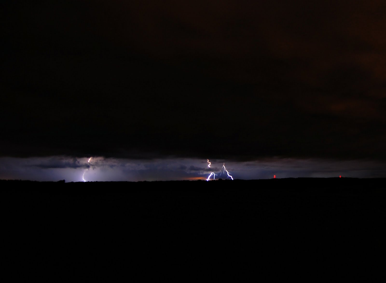
we had our worst wind storm in a couple of years blow through Omaha between 7 and 730 pm. winds were measured between 65-80 mph across most of the county, especially the western half, west of interstate 680. it was the hottest day of the summer and combined with oppressive humidity made it feel like 115 degrees outside, even though the air temp was "only" 97 degrees. the storms developed west and northwest of town and slowly strengthened until they started producing 70 mph winds about 20 miles west of town. i went out west of town down to 226th and maple. we live near 156th and maple. i left too late to get a lot of good pictures or video, and actually it was so muggy out that my lens on my camera immediately fogged up anyways the second i stepped out of the car! i was not that impressed with the structure of the storm compared to some others i've seen. normally storms that are this strong have a really nicely developed shelf cloud. as i was watching the storm come in, it was kicking up a lot of dust out in the fields several miles away. i was watching the radar, and the storm started to bow out as it was getting closer, signaling the winds were getting stronger. when the winds started to pick up at my location, i got back in the car and tried to race back home down maple street. i hit several stoplights of course, so i never really got back in front of the storm all the way. as i was driving, leaves and small branches were blowing across the road and one big gust of wind actually pushed my car over quite a bit. i made it home to the sirens blaring, which they activate if winds are forecast to be over 75 mph! i watched the storm out our windows and after the inital surge of winds that were maybe 50 mph, the winds let up. i thought this was it, but after another 4-5 minutes or so, the main damaging winds hit. winds at my place were near 70 mph i would say. my weather station on our roof blanked out, and still isn't working, so i don't know exactly what the strongest winds were. as i watched out our back door, i could see the neighbors house losing its shingles. a few small branches broke, but i was surprised how few branches there were on the ground. back west along maple street, there were a couple of large trees that blew over a few minutes after i had passed. the storm had seemed to let up a little at our house, when suddenly the power went out. it went out for not more than 5 minutes when it came back on. however, it only stayed on for another 5 minutes or so again, before going out again. this time it stayed off until after 11 pm! it was odd to notice where the power went out too. literally if you went 2 blocks north, east, or west there was power. however if you headed south, everyone was without power for quite a ways. i believe oppd said at one point there were 43, 000 people without power in its district, with 27,000 of those here in omaha. we went over to sarah's sister's house since they still had power. the backside of the storm was amazing! first there were intense cg lightning strikes. i was inside, and after hearing about the 4th or 5th loud boom, i went out to try and capture one on camera. of course the lightning really let up then. the sun then started to come out and created almost a full double rainbow. it was awesome to see, but i wasn't quite as excited as this guy in this video!! seriously watch this video, and try not to bust a gut laughing:

http://www.wimp.com/lovesrainbows/

anyways, the lighting from the sun after the storm was also awesome. here's some pics below.

here's a link to the wind gusts across the area:
http://www.crh.noaa.gov/news/display_cmsstory.php?wfo=oax&storyid=55153&source=0