Well after this chase, I wanna say that I have seen my first tornado!! BUT, it wasn't the "picture" i had imagined in my head of a nice big tornado out in an open flat field with clear visibility all around it! In the end I barely missed seeing a tornado clearly, and then a tornado barely missed me!!
Originally, I wasn't going to go out chasing this day because at first the risk and outlook area was going to be for mainly high winds and the area was going to be eastern missour and iowa and rapidly moving away. but the forecast changed eventually leading to a moderate risk issued for most of northern Missouri and Illinois all the way back into Oklahoma. i finally decided that even though this would be a longer chase, it could be very rewarding so i decided to go for it. at one point i almost was going to go south into southern Kansas and northern Oklahoma, but that was getting some 5-6 hours away, and the northern Missouri target was about 4 hours away. i left omaha around 10 am and arrived at my initial target of Macon, Mo along highway 36 in northern missouri. i ate some food at a horrible hardee's and waited around town for a couple of hours for initiation to start. while waiting in a parking lot, i was on stormtrack and saw a message from another chaser that was waiting in macon as well and he was thinking about going north to kirksville area. i replied to tell him i was in town as well, but thought i would wait here. MISTAKE!! around 415-430 i believe, the first tornado warning suddenly came out for a cell about 20 miles west of kirksville. i wasn't going to go after this storm bc it didn't look that great on radar at first, but i looked around though and there was nothing else so i decided to head north. kirksville was only 30 miles away and i had a nice straight highway that i could take to get there. as i headed north several things started happening rapidly. 1)it became dark very fast, and suddenly i had a great view of the huge towers exploding. 2)a second cell to the southwest became tornado warned. i almost broke off my route and headed towards that cell but chose to keep going north. 3)the tornado warnings coming out west of kirksville were now for a tornado on the ground! 4)finally there was a cell that was developing south of kirksville that was beginning to already form a wall cloud. i kept watching the wall cloud form to my west and about 5 miles south of kirksville, i started to run into rain and hail. i made a last minute decision to stop and get some video and a better view of the wall cloud even though there was still a tornado on the ground about 6 miles west of kirksville now. i really kind of regret that now! i took a road that was only 2 miles south of kirksville and headed west. i eventually came to the top of a ridge and turned into a gas station parking lot and took a couple of minutes of video of the wall cloud. i left after the wall cloud began to look a little less ominous and I headed into kirksville. i had to drive through most of town to get to the highway 6 that i wanted to take west out of town. when i turned onto the highway there was a bridge or viaduct or something and here there were a bunch of chasers and other vehicles. i immediately pulled over and got out just in time to see the tornado becoming totally rain wrapped!! i just missed having a perfect shot of the tornado!! i recorded about 30 seconds of video before i could see the rfd coming rapidly towards me. everyone began to get in their cars and leave, so i did a u-turn and left as well. i headed back south through town looking for a good road that would take me east out of town where i could parallel the storm as it moved east. my gps showed a road, highway 11, that would lead me out of town. i remember seeing a road closed ahead sign after i turned onto the highway, but i figured there would be a detour. as i headed east i had a good view of the storm to my north. it was very impressive with all kinds of intense motion in the clouds. i stopped briefly for a better view and was thinking the tornado was still a ways back bc it had been moving so slowly prior to reaching kirksville. after 5-6 miles or so, the highway turned to the north which led me right into the storm. this was only a brief 1-2 mile jog before the road turned back to the east though. as i turned to the north, rain began to fall pretty heavily, but there was no real wind or even hail. i continued on down the highway for a couple of more miles before, sure enough i ran into the road closed sign and there was no detour. i had to turn around! the rain had already pretty much stopped and soon after a while the sky began to lighten up. after a couple of miles of driving back west though i began to notice debris on the road like leaves and small branches. soon i noticed leaves falling from the sky despite there being no trees real close to the road and there was no noticeable wind. a little bit further i started to notice metal and insulation stuck in the fence on the side of road, and then i came upon a power pole broke over the road and the fencing from one side of the road blown across the road. THE TORNADO HAD JUST CROSSED THE ROAD RIGHT BEHIND ME!! i was totally amazed and then kind of freaked out. i have since gone back and watched my video to see how long it took me to drive through this spot and then return when i had to turn around, and it was only 4 minutes and 30 seconds which means the tornado missed me by 2 minutes at the most!! there was already one car stopped at the point where the fence was down, and soon 3 other cars that were a group of storm chasers came by as well. i looked out to my right and out in the field you could see the ground where the tornado had crossed. the ground was scoured with circular marks. i looked back towards the direction of the storm and there was a very noticeable feature that at first thought was just a hail shaft, so i didn't take much video and no still pictures. but after reviewing my video and taking a closer look, i'm 99% sure that this was the rain wrapped tornado. it would have had to be it, since it had just crossed the road here and was now several miles away. about this same time there was a report of a large tornado on the ground about 10 miles east of kirksville which would have put it in the same area as where i was seeing the tornado. after a bit i headed back down the highway into kirksville. there were already reports of the tornado ripping through north kirksville with lots of reports of damage and possible injuries. eventually it was found that 3 people died. i thought about going to try and get some good damage pics and video, but thought that would just be crazy to try and get up to that part of town. so i made one last effort to catch back up with the storm on highway 6 east, but gave up after driving through tree lined roads and experiencing no cell phone coverage and therefore i had no internet. i turned back around and started the 4 hour trip home. what a day!!
link to a picture that was sent to me of the tornado that crossed the highway right behind me as it was crossing the road. notice the white house. the fence that we had to stop for was blown across the road right by that house!
http://tornadolive.com/closetorns.jpghere are some good links to various pics and video and stories:
the forum that i go on all the time for my storm chasing. alot of good pics and stories to look through from this day
http://stormtrack.org/forum/showthread.php?t=20699links to pictures from kirksville newspaper:
http://www.kirksvilledailyexpress.com/news/x342398818/Photos-from-Wednesdays-Tornadoes?popular=truecrazy youtube video of a chaser that almost gets caught in the tornado. if you search on youtube for kirksville tornado, you'll find a whole bunch more:
http://www.youtube.com/watch?v=HCwADHa0crk&feature=relatedothers:
http://www.youtube.com/watch?v=GdG7C2A9DyEhttp://www.youtube.com/watch?v=RV02MKZE1kwdamage surveys:
http://test.crh.noaa.gov/eax/?n=severewx-20090513
towers exploding as i head north towards kirksville

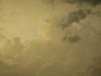
another shot of the anvil of the storms

shot of ominous wallcloud 2 miles south of kirksville

wall cloud again

video grab of tornado becoming rain wrapped. tornado is in the "stuff" to the left

picture taken by another storm chaser that came upon me stopped in the road due to debris. that's me getting out of the malibu in the picture!!


video grabs of the tornado from the back after the tornado had crossed hwy 11 right behind me!

shot of the huge cumulus clouds

one more storm on my way back down to macon and hwy 36 on my way home

more pics of the storms to the north of macon on my way home
again

one more!


