Thursday, May 27, 2010

5/22/10 SD tornadoes

If I had this one to do over...... Today was a day that every chaser dreams about and wishes they were there/ regrets that they didn't go, me included. Originally, this day looked like it was going to be a good chance to go chasing relatively close to home in central nebraska. with each successive model run though the best ingredients were coming together further and further north. i hadn't been chasing in a couple of weeks, so i thought i will still go. it was a saturday, and chase season is already down to about 6 weeks left. i went to bed thinking i would have to go up west of yankton further in s. central south dakota. when i woke up saturday morning though, the best area looked to now be north of pierre, in fact i set a virtual target of right around gettysburg, sd. i still almost wanted to go with the idea that after a seven hour drive and chasing, i would at least have a place to stay if i ended up around home before driving back to omaha on sunday. alas though, i decided to sit this one out. the potential was there with some of the best ingredients seen anywhere in the plains this spring, however there was still some concern of the cap. throughout the afternoon i kept checking things and became increasingly worried about what could happen in northern south dakota. the storm prediction center raised the tornado probabilities and also added a hatched area, which means the potential of strong tornadoes. finally around 430-445, the first blips showed up on radar around akaska, sd about 20 miles northwest of gettysburg! i watched the storm explode on radar and within 30 minutes, the storm was tornado warned. i had to leave home for about 30-45 minutes and came back to a monster supercell on the radar with a huge hook, located west of bowdle, sd. reports were coming in of a large, dangerous tornado on the ground. i was able to watch it live on streaming video and it was extremely large! the storm went on to produce tornadoes over the next roughly two hours, producing 7 separate tornadoes. luckily, the large, violent tornado went one mile north of bowdle and all the other tornadoes missed any major towns. the bowdle tornado was rated an EF-4!! i've included links to info and pics as well:

damage survey results:
http://www.crh.noaa.gov/product.php?site=abr&product=pns&issuedby=ABR&format=CI&version=1&glossary=0

my favorite part of the damage survey:
TWO LARGE GARAGES WERE COMPLETELY DESTROYED WITH THE
CONCRETE SLAB WIPED CLEAN. THE VEHICLES IN ONE GARAGE WERE
ROLLED/TOSSED FROM 25 TO 100 YARDS AWAY. IT IS ESTIMATED THAT ONE
VEHICLE FLEW THROUGH THE AIR 75 TO 100 YARDS RESTING IN THE TREE
SHELTER BELT TO THE NORTH OF THE RESIDENCE.

LOCATED JUST NORTH OF THIS RESIDENCE...SEVERAL METAL POWER
TRANSMISSION TOWERS WERE TOPPLED. ONE TOWER WAS SHEARED OFF FROM
THE CONCRETE FOOTINGS AND TRAVELED AN ESTIMATED 400 YARDS AWAY.
THERE WERE 6 TO 8 OF THESE TOWERS TOPPLED. GROUND SCOURING WAS
VISIBLE ALONG THE PATH OF THESE TOWERS. THE DAMAGE TO THE TOWERS
IS CONSISTENT WITH AN EF4 TORNADO RATING WITH WIND SPEEDS FROM
166 TO 200 MPH.

more info on the tornado:
http://www.crh.noaa.gov/news/display_cmsstory.php?wfo=abr&storyid=52954&source=0

some of the amazing pics, videos, and stories of other storm chasers that were there:
http://stormtrack.org/forum/showthread.php?t=24152

few videos off of youtube:
http://www.youtube.com/watch?v=GGqINBsCPFg
http://www.youtube.com/watch?v=jiYY6uisMYo
http://www.youtube.com/watch?v=8U8FK47vfzA

radar grabs:

5/24/10 Western Nebraska

Today was kindof a last minute chase. Originally, i wasn't going to head out bc the best chances of severe weather was up in western south dakota, but i had a buddy contact me who i hadn't gone out chasing with in a couple of years, so i said yes. we headed out with an initial target of north platte, nebraska. this was on the southern edge of the 10% chance of tornadoes, and i figured we could hopefully catch the storms that would be racing north at 60 mph out of kansas just as they entered this area of higher tornado probabilities. storms fired really early in the day and tornado watches were out by 1pm i believe. as we headed west several tornado warnings were issued in the panhandle of nebraska north into south dakota and even in eastern north dakota. after these initial cells moved out of nebraska, nothing further developed for several hours and the storms that came out of kansas died as well. the clouds would start to go up but would get choked off after about 15-20 minutes it seemed. we made a decision to start heading north where there were a few small cells that would hopefully do something. one of the cells actually had a tornado warning issued briefly for it, but it was already about 20 miles away from us and moving at 65 mph so it was impossible to catch. eventually we ended up at broken bow nebraska with still mainly blue skies over us. we ate and were going to head back home defeated. there was a line of storms that was developing pretty good along the cold front that was now moving in from the west. after only heading back east for about 15 miles we decided heck with it we're this far west let's go and intercept the line moving through. we went back down to I-80, and headed west towards north platte, eventually reaching the town of cozad about 30 miles east of north platte. there we targeted the southern cell of the line moving towards the interstate to our southwest


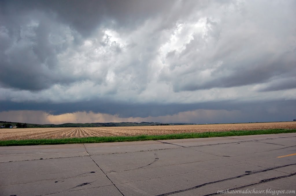
this was the first view we had of the base of the storm. notice the very slight lowering. it was obviously very hard to tell what this was from this distance

a view of the storm heading towards us

again

again

pic of another cell trying to go up back to our east, this one would also die shortly after

we moved down the highway closer to the storm and got this pic

this was the next stop down the road. we are southwest of cozad, and southeast of gothenburg. about this time the storm went tornado warned

velocity grab on the radar a little after this. notice the white circle, that is our location. the green next to the red in the middle just above our position is the rotation in the storm

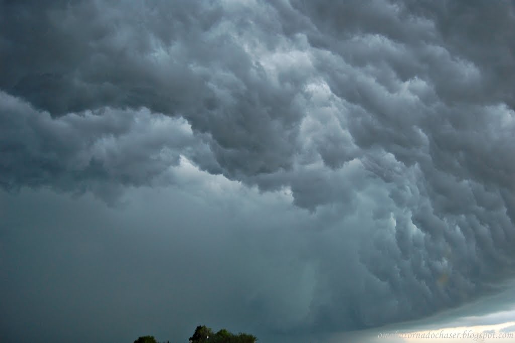
this looked to be mainly scud, but you could see the broader rotation in the storm

about heare is where a persistent wall cloud developed. hard to tell the rotation from this point

again


we headed back east to stay ahead of the storm and to try and get back to a road that would take us north across the interstate to try and stay with it. again this storm was moving at near 60 mph! it had ping pong ball sized hail with it as well


we're now north of cozad on the other side of the interstate. the storm is no longer tornado warned, but still has large hail and gusty winds

another pic north of cozad

driving down the interstate taking a pic out my window!

stopped one more time back ahead of the storms to try and get some lightning pics. of course here it wouldn't drop a bolt at all. back in cozad, i experienced some of the most intense lightning ever just as we pulled up to a gas station. i actually didn't feel safe running to and from my car! i wanted to try and get a pic of one of these bolts, but again i FELT TOTALLY UNSAFE, even just having my window open.

here is a link to the storm reports from that day:
http://www.spc.noaa.gov/exper/archive/events/100524/index.html

this is the website for stormchaser reports. there was another rather large tornado in south dakota this day that was seen by a lot of chasers. this one was only rated a EF-2, though i bet it was probably stronger at points when it was out in the open country.
http://stormtrack.org/forum/showthread.php?t=24186


so another chase without a tornado, and none again this year. as i write this report it is almost june and probably only a month left in the season. the forecast is calling for severe storms this tuesday, and then the flow turns to northwest. this weekend i'll be watching for any storms as there will be very high instability and strong shear over iowa where i will be staying with sarah's family. it could be a big event that day! last night and today omaha was missed by more tstorms. they weren't severe but it was rather amusing to watch the storms die right before they got to omaha late last night and early this morning, then sure enough this afternoon the front moved through with nothing, but then 30 miles east and southeast of here storms formed and of course then missed us again. i think i've seen 2 storms here in omaha so far this spring. c'mon june, don't disappoint!!

Tuesday, May 11, 2010

5/10/10 High risk chase day

Today was one of those "less than a handful" of days of chase opportunities that come along every year, but for me it was still borderline on whether to go. the spc issued a high risk early in the morning of may 10th. a seasonably strong low pressure with a very intense jet stream over 100 kts was going to move through the central and southern plains. unlike a few of the previous storm systems, moisture would not be a problem, and the shear needed for storms to rotate would be off the charts. about 5 or so days before, forecasts showed the best place to be across most of kansas. as the date arrived though the forecast changed to having the best chance of an outbreak down into texas and oklahoma. even the day before the models were slightly different, but eventually settled on most of oklahoma and extreme southern kansas. i knew i couldn't go all the way down to oklahoma, but when the first day one outlook was issued, there was still a 10% chance of tornadoes across most of kansas increasing to 30% in southeastern kansas in the high risk area. i decided i would wake up in the morning and see how things were looking and then decide whether to go. looking at the models, i tentatively decided to head a little west/soutwest of wichita, kansas somewhere around the kingman, ks area. i woke up to see a lot of cloud cover over most of the risk area which worried me, but this was supposed to clear out. i had a time that i wanted to leave by but unfortunately didn't get going until about an hour later than planned. this would come back to bite me! i left town around 1245 and headed west on I-80, and then south on hwy 81 through nebraska and into central kansas. it was rainy, windy, and very cool all the way to central kansas. storms were starting to fire in southwest and western kansas already. as i got closer to wichita some of the first storms were starting to reach me with heavy rain and lightning. there was finally one monster storm that developed southwest of wichita heading towards the east/northeast at 50-60 mph. one of the reasons there was a high risk that day was for strong, long track tornadoes, and the reason for the threat of long track tornadoes was because of the storm motions expected to be near 50-60 mph. back to the storm heading towards wichita, it was located near kingman, kansas! as i raced south to try and get it front of it, i couldn't help but think i should already be there. this is a bad habit i've developed storm chasing where i don't leave when i want to, and then miss something big. this usually happens on longer trips where i try to debate whether i should even go or not because of how far the drive will be. it's something that i need to fix! well, i didn't make it down there in time to get in front of the storm where i wanted to. i was approaching wichita at rush hour and didn't want to have to worry about being on a crowded highway with a possible tornado bearing down on me and no way to escape. so i decided to head east and then south around wichita. unfortunately the storm died as it approached and then passed by wichita. by the time it reached me there was just some gusty winds and small hail. i was given a taste though just how dangerous it could have been. the storm bases were basically on the ground. it looked like i could have thrown a baseball up into the clouds they were so low. also they were moving extremely fast and the shear was obvious in the clouds as they were moving in all different directions. so after driving for four hours, i spent about 45 minutes east of wichita, and then turned around to make the long drive home.

the first day one outlooks tornado chances hail chances


1630Z outlooks

here are some radar grabs of the storm near kingman, ks. look at that hook!!


velocity images, notice the couplet(green next to red) strong signs of rotation!


on my way home there was one last small line of tstorms that became warned as i was driving towards them. i was heading north on I-135 and the storms were heading east towards me. i stopped right near mcpherson, kansas on a highway overpass to let the storm come over me. it was warned for quarter sized hail and winds up to 60 mph. at one point the hail indicator indicated over 2" hail as it was approaching. of course, the storm weakened once it finally reached me, but winds were still over 40 mph and there was some pea sized hail. i took a series of great pics as it approached.


meanwhile there was a tornado outbreak ongoing in oklahoma. several suburbs of oklahoma city and other areas of north central to eastern oklahoma were hit by strong tornadoes. i grabbed some radar images of one of the first storms that was ongoing while i was approaching wichita. again a textbook example of supercell with an amazing hook!!


finally on my way home, i was stopped and received a stupid speeding ticket! i was just pulling into some small town where the speed limit drops down to 55. i had just started slowing down, but not fast enough bc there was a cop basically right on the other side of the sign where it changed. so he got me for going 69 in a 55, a $123 ticket!! he asked where i was coming from and i told him storm chasing but he only seemed mildly interested and then gave me a ticket anyways! so what did i learn from today's chase? commit to a chase earlier, high risks chase are always "risky" bc they can involve storms that move way too fast to even keep up with, and lastly follow all posted speed limits!